Channel Islands

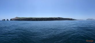
"The Galapagos Of North America," are composed of eight islands that make up The Channel Islands just off the Southern California coast. You can see several of these islands from the California mainland, however, many people never set foot on the islands to experience how magical they truly are. San Clemente and San Nicolas Islands are controlled by the military and access is not allowed but five of the islands make up Channel Islands National Park (Santa Barbara, Anacapa, Santa Cruz, Santa Rosa, and San Miguel). Catalina Island is the only island accessible to the public that is not part of the national park. These islands have many endemic plants and animals which can be found nowhere else on the planet. There are several ways to get to and from the islands, Catalina Island is the most accessible with ferry services from Long Beach, Newport Beach, and Dana Point, it's also accessible by air via plane or helicopter charter with IEX Helicopters. Catalina is the only Channel Island with a town open to the public, known as Avalon. The other islands are much more isolated which is a great thing if you're looking to explore without many people around. Santa Cruz and Santa Rosa Islands are easily accessible from Ventura and Santa Barbara aboard a ferry with Island Packers who offers trips to all five of the Channel Islands National Parks. You can take a single day trip there and back or camp out overnight.

Did you know the oldest known human remains in North America were discovered on Channel Islands? The Islands have lots of history dating back to the original inhabitants of what is now California. In more recent history, some of the islands had ranches with livestock grazing them before they were inducted into the national park system.

Anacapa Island
Anacapa Island
Anacapa Island
Anacapa Island
Anacapa Island
Anacapa Island
Anacapa Island
Anacapa Island
Anacapa Island
Anacapa Island

Anacapa Island

Size rank: #7 (699 acres)

Highest Point: 930 ft.

Population: 3 (Park rangers)

Access: Public

Conservation: National Park

Length: 5 miles

Closest land: 9 miles (Port Hueneme)

County: Ventura

Transportation: Island Packers (Oxnard & Ventura)

The closest island to mainland of all the Channel Islands, Anacapa is located just 9 miles from the coast. Anacapa is the only island in the chain without a Spanish name, instead the name derives from the native Chumash People. Composed of 3 sections (West, Middle, and East) which are not accessible from each other, East Anacapa is the only one with a landing and a trail system. Anacapa Island is home to the largest breeding colony of brown pelicans and is home to several other seabird breeding colonies as well.

San Clemente Island
San Clemente Island
San Clemente Island
San Clemente Island
San Clemente Island
San Clemente Island
San Clemente Island
San Clemente Island

San Clemente Island

Size rank: #4 (36,358 acres)

Highest Point: 1,965 ft.

Population: 148 (approx.)

Access: U.S. Navy and U.S. Air Force

Conservation:

Length: 21 miles

Closest land: 41 miles (Palos Verdes)

County: Los Angeles

Transportation: None

The southernmost island in the Channel Islands chain, San Clemente Island has been owned by the U.S. Navy since 1934 and has a runway is long enough to accommodate any size plane/jet in the military. Although the area surrounding the island is popular for diving with its clear water and kelp forests, the public cannot set foot on the island. During World War II, this island played a crucial role for amphibious vehicle landing training. The island has many types of testing by the military and is home to a mock Afghan city training facility for the Navy SEAL's. It's common to see military training in the area surrounding the island including battleships, aircraft carriers, hovercraft, helicopters, and other vehicles from several different countries.

San Miguel Island
San Miguel Island
San Miguel Island
San Miguel Island
San Miguel Island
San Miguel Island
San Miguel Island
San Miguel Island
San Miguel Island
San Miguel Island
San Miguel Island
San Miguel Island
San Miguel Island
San Miguel Island
San Miguel Island
San Miguel Island

San Miguel Island

Size rank: #6 (9,325 acres)

Highest Point: 831 ft.

Population: 1 (Park Ranger)

Access: Public

Conservation: National Park

Length: 8 miles

Closest land: 26 miles (Point Conception)

County: Santa Barbara

Transportation: Island Packers (Ventura)

Holding one of the largest concentrations of wildlife in the world, there are 5 pinniped species that can be found here along with 1/3 of all the breeding bird colonies of the Channel Islands. There is no pier or landing to get onto this island so the only way is anchor and take a skiff or swim ashore.

San Nicolas Island
San Nicolas Island
San Nicolas Island
San Nicolas Island
San Nicolas Island
San Nicolas Island
San Nicolas Island
San Nicolas Island
San Nicolas Island

San Nicolas Island

Size rank: #5 (14,562 acres)

Highest Point: 905 ft.

Population: 200 (approx.), no permanent inhabitants

Access: U.S. Navy

Conservation: Military and volunteers

Length: 9.2 miles

Closest land: 61 miles (Ventura)

County: Ventura

Transportation: No public access

The most remote of all the Channel Islands, The U.S. Navy controls this island and uses it for training, testing, and telemetry for rockets launched from Pt. Mugu. A small airport serves as the main means of travel to this island, the runway is large enough to accommodate any military aircraft. There is also a pier which is used for supplies but there is no harbor. The Navy allows access to some civilians performing conservation work like native plant restoration.

In 1990, sea otters were brought to the island as part of a conservation effort in case any type of disease overwhelms the coastal population. This population of otters are completely isolated. There are breeding colonies of harbor seals, sea lions, and elephant seals on the beaches around this island.

This island is most notable for its Native American history including the story of a lone woman who lived alone on the island for 18 years. When Spanish Missionaries came to the island in 1835, they forced everyone to board their ship to mainland and become Christian or be killed. The lone woman hid out and become the islands sole resident where she remained until another boat came for her in 1853. After arriving at Mission Santa Barbara, she was baptized and forced into Christianity before passing soon after, likely due to disease. Her birth name remains unknown but she was referred to by her Spanish assigned name, Juana Maria. This was known as "Island of the Blue Dolphins" which is a popular novel.

Santa Barbara Island

Santa Barbara Island

Size rank: #8 (640 acres)

Highest Point: 634 ft.

Population: 2 (Park rangers)

Access: Public

Conservation: National Park

Length: 1.7 miles

Closest land: 38 miles (Malibu)

County: Santa Barbara

Transportation: Island Packers (Ventura)

The smallest of all the islands, this is the least visited due to its difficulty of access and remoteness. There is also no pier to dock at. This island only has about 1 square mile of land and it is completely remote with no resources. If you camp on this island, you may be the only one on it. Snorkeling and diving around the island offers amazing clarity and giant kelp forests full of fish.

Like many of the other islands, there are colonies of sea lions, elephant seals, and harbor seals. 11 species of seabirds nest on this island along with many land birds that are endemic to the island.

Catalina Island
Catalina Island
Catalina Island
Catalina Island
Catalina Island
Catalina Island
Catalina Island
Catalina Island

Santa Catalina Island

Size rank: #3 (47,987 acres)

Highest Point: 2,097 ft.

Population: 4,100 (approx.)

Access: Public

Conservation: Catalina Conservancy

Length: 22 miles

Closest land: 22 miles (Palos Verdes)

County: Los Angeles

Transportation: Catalina Flyer (Newport Beach), Catalina Express (Dana Point & Long Beach), IEX Helicopters (John Wayne and Long Beach Airports), Pacific Offshore Expeditions (Newport Beach)

The most easily accessible of all the islands, Catalina is a great place to visit with a lot of activities! Snorkeling, scuba diving, zip lining, bison viewing, wine tasting, hiking. You can spend the day hanging out in the town of Avalon or visit Two Harbors which is much more quiet but still has facilities like restrooms, picnic tables, a cafe, bar, and market.

Santa Cruz Island
Santa Cruz Island
Santa Cruz Island
Santa Cruz Island
Santa Cruz Island
Santa Cruz Island
Santa Cruz Island
Santa Cruz Island
Santa Cruz Island
Santa Cruz Island
Santa Cruz Island

Santa Cruz Island

Size rank: #1 (61,764 acres)

Highest Point: 2,429 ft.

Population: 2 (Park rangers)

Access: Public

Conservation: National Park, Nature Conservancy

Length: 22 miles

Closest land: 20 miles (Port Hueneme)

County: Santa Barbara

Transportation: Island Packers (Ventura)

The largest of all the Channel Islands, there is a lot to see here! You can visit Scorpion Anchorage or Prisoners Harbor with Island Packers. Both of these locations are beautiful and offer a lot to explore. If you want to visit Channel Islands National Park without having to feel like you've been dropped off on a completely remote island, this is probably the island you'd want to visit. At both of these anchorages, you'll find restrooms and some info about the local history. Scorpion Anchorage is probably the favored spot as it has the most activities. It is the easiest place of all the islands to see island foxes which are endemic to the Channel Islands. At Scorpion Anchorage, they wander around the campground, make sure to keep all food secured so they can not access it. You can also do a kayak tour which is highly recommended! The guides will show you the sea caves, kelp forest, and provide lots of great info while showing you a good time. If you decide to hike, there are a few different trails which all offer great views, however, there is not much shade once you get away from the campgrounds so be prepared with plenty of water, food, and know your limits.

Santa Rosa Island
Santa Rosa Island
Santa Rosa Island
Santa Rosa Island
Santa Rosa Island
Santa Rosa Island
Santa Rosa Island
Santa Rosa Island
Santa Rosa Island
Santa Rosa Island
Santa Rosa Island
Santa Rosa Island
Santa Rosa Island
Santa Rosa Island
Santa Rosa Island
Santa Rosa Island

Santa Rosa Island

Size rank: #2 (53,195 acres)

Highest Point: 1,589 ft.

Population: 2 (Park rangers)

Access: Public

Conservation: National Park

Length: 15 miles

Closest land: 30 miles (Santa Barbara)

County: Santa Barbara

Transportation: Island Packers (Ventura)

Previously used as a cattle ranch before being turned over to the National Park Service in the 1980's, you can see much of its ranching history right when you get on the island. The island was overgrazed heavily and the NPS is restoring many of the native plants while keeping the history intact. Some notable features on this island are its Torrey Pines, sand dunes, and white sand beaches. There are campsites and plenty of hiking trails as well. In recent years, many gray whales feed in Bechers Bay in late winter and can easily be seen from the pier or beach.